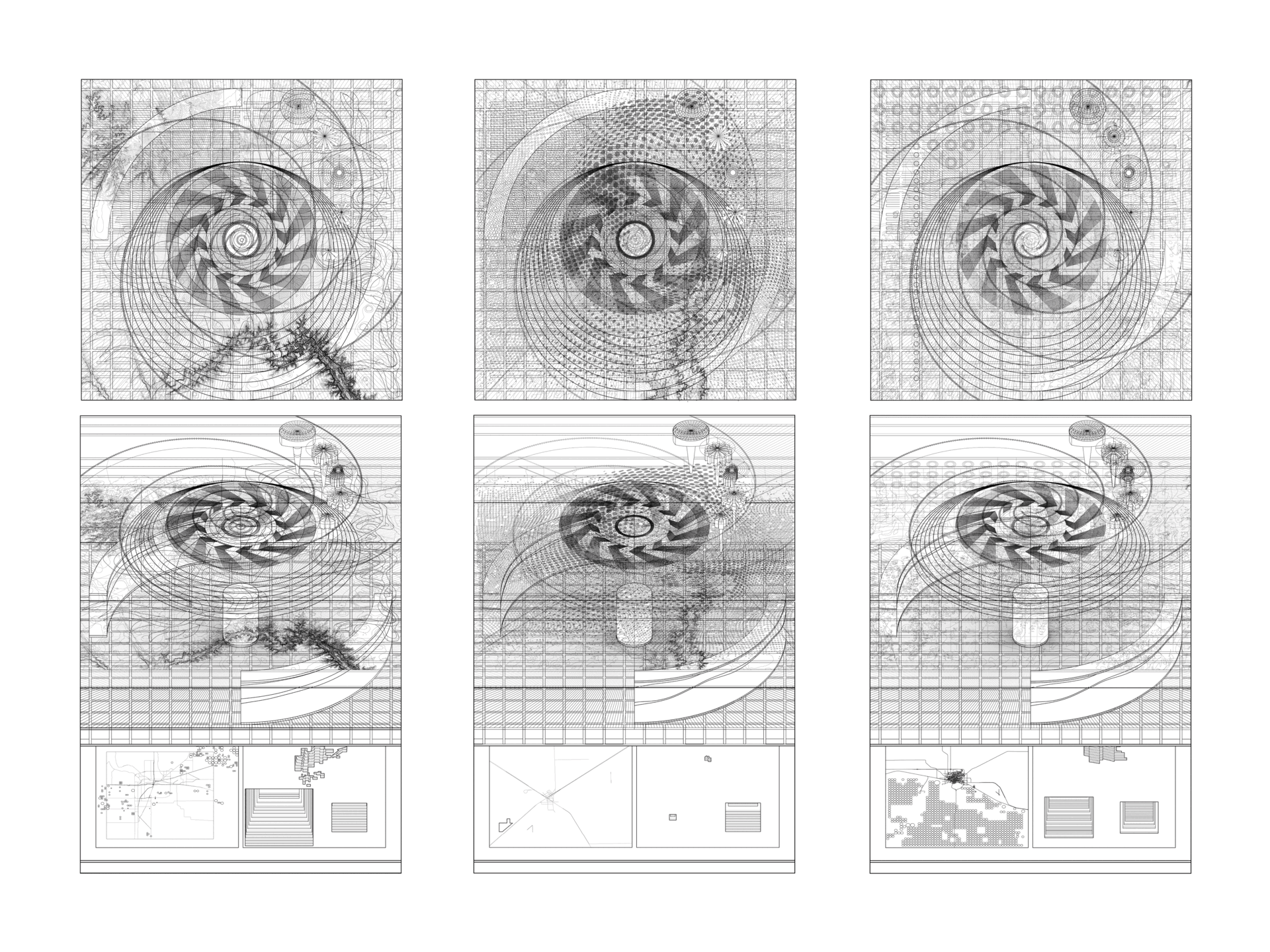
With a design process that takes advantage of the technological frontier, I’m utilizing my ever-evolving catalogue of translational techniques to create an archive of spatial manifestations of a different set of collected data: The Great Plains as a representation of American arid landscapes.
The built environment of the Great Plains is constrained, controlled, and defined by the Jeffersonian grid, crop circles, groundwater, and management policies. The current colonial practices, which inform the policies at play, are not in line with recent changes in the geography of these lands brought upon by climate change and recurring droughts. This research explores the southern Great Plains, its environmental and temporal processes, and its operational extent. The first step of this multi-staged exploration is to visualize and make spatial the carefully extracted data regarding the often invisible forces at the unperceivable scale, such as operational and systemic flows, societal effects, and the changing climate.
By layering transparent material entities, from depictions on plexiglass to resin models, I construct a “space-time-data” continuum model where time does not progress linearly forward but loops upward in a spiral.